Subscribe to our mailing list to receive news releases and other materials related to Provenance Gold Corp. Your email will never be shared or sold and you can opt out at any time.
An initial NI 43-101 technical report has been completed on the White Rock Gold Property. The purpose of this report was to form a baseline for the Property and will be updated further in 2023 following a second drill program planned that is fully permitted. The planned drill program is being designed to expand upon significant zones of gold mineralization confirmed during the 2021 drill program.

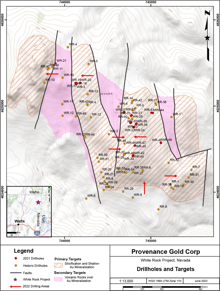
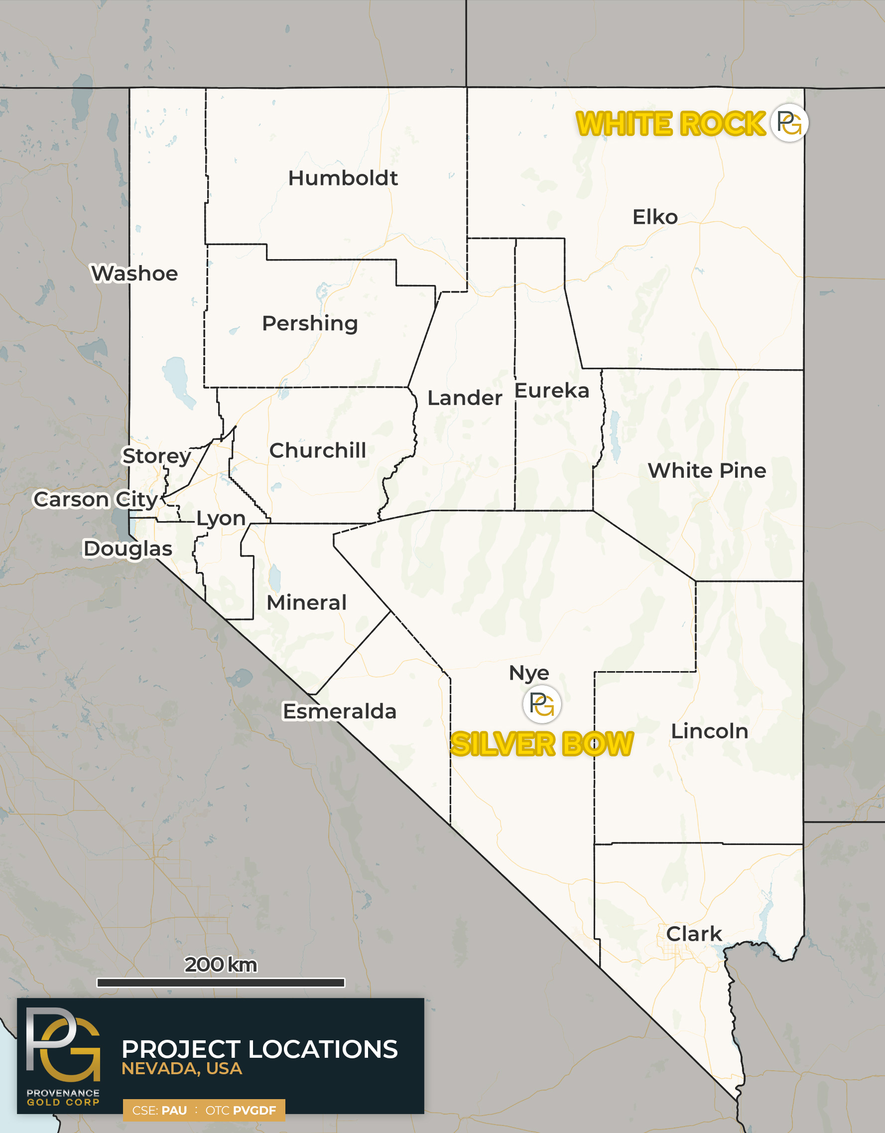
Provenance’s White Rock property in the northeastern corner of Elko County, Nevada hosts a large gold system within its 117 claims covering 2,396 acres. The gold system extends across an open-ended area of at least 3.2 Km by 1.6 Km. The gold system is hosted in Permian sedimentary formations and is both structurally and stratigraphically controlled. The structural controls include a north-trending fault system and a faulted complex anticline. The anticlinal structure is believed to be developed on the upper plate of an underlying thrust sheet complex. Scattered widely spaced historical drilling of parts of the property with distances between holes up to 290 meters apart confirmed the extensive mineral system. The drill holes intersected thick intervals of gold mineralization up to 5.7 g/t gold. Provenance believes the geology of the White Rock mineral system has similarities to the geology of the nearby Black Pine gold system in southern Idaho. At Black Pine, the gold system is hosted in a complex of thrust faults. A similar thrust complex underlies the White Rock mineralization, and the thrust complex will be a future exploration target.

All past drilling was widely spaced with distances between holes ranging from 200 feet (66m) to about 900 feet (290m) and was open ended on trend. Current interpretation leads the Company to believe the property contains a large shallow gold system.
A review of 65 historical drill holes found 191 intervals that assayed between 0.01 opt gold (0.34 g/t) to 0.166 opt gold (5.7 g/t) over intervals from 10 to 95 feet. These holes were widely spaced with distances between holes up to 290 meters apart and over a mineralized area of approximately four-square kilometers. Significant historical intercepts included:

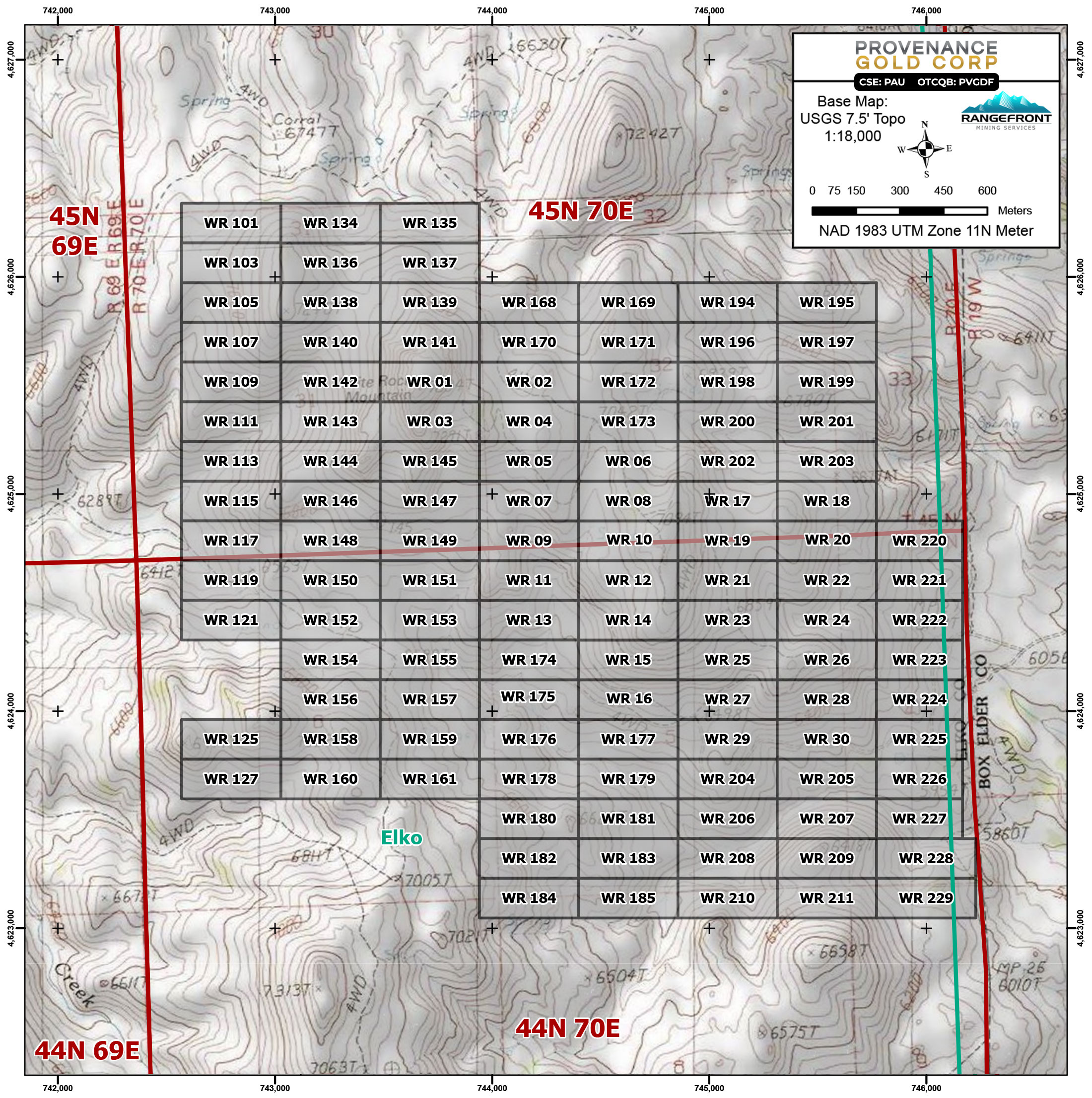
The White Rock property consists of 117 claims covering 2396 acres. In 2024 the Company completed payments totaling US$250,000 over 4-years for an option to purchase, and now has 100% interest in the project with advanced royalty payments set annually at US$25,000, and a 2% NSR royalty on production for the Vendor.
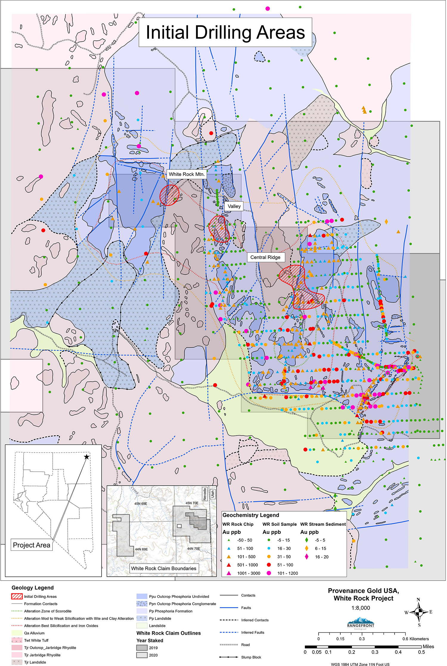
The property is located in a NW trending wrench fault system and is hosted in Permian cherts, limey cherts, and limey siltstones. The property features an epithermal system with fracture controlled gold deposition. Sedimentary host rocks are silicified (jasperoids), limonitic and brecciated, with gold mineralization introduced during early structural development in stockworks in brittle zones. The nearest gold mine is Liberty Gold's Black Pine Mine which Provenance believes is in a similar geological setting.
Provenance has completed an initial drill program on the property to confirm the historical drilling and Provenance’s new gold system model. Although the gold system extends northwestward through White Rock Mountain and well beyond, Provenance’s initial program started on the southeastern margin of the mountain because of easy access and a good historical data base. The drilling then progressed southeastward toward the strongest surface mineralization. Challenging drilling conditions that shouldn’t present difficulties going forward have resulted in many holes having to be terminated before cutting through their targets, although most have reached the upper levels of the gold system. The completed holes and partially completed holes together with historical information and detailed structural modeling substantiate Provenance’s gold mineralization model and the large size and thickness of the gold system. Two of Provenance’s holes that successfully penetrated the gold zone in the company’s initial northern drilling target area provide confidence the zone is thick and continuous.
Hole WR-15 was drilled vertically to test disseminated gold mineralization in the sedimentary rocks that host the system. Starting with 2.35 g/t gold over 1.5 meters, a strong interval of 29 meters of 0.636 g/t gold was followed closely by another 53 meters of 0.197 g/t gold. Both intervals each contained 7.6 meters of 1.45 g/t and 0.427 g/t gold. The anomalous gold mineralized zone had a cumulate thickness of 100 meters (328 feet).
WR-16 intersected a 55-meter (180 feet) interval that averaged 0.618 g/t gold starting with 1.5 meters of 3.55 g/t at 29 meters and ending with a 6-meter interval that averaged 2.3 g/t. The 55-meter-thick zone also contained 7 assay intervals over 1 g/t gold. It was stopped at 100 meters (328 feet) due to drilling conditions. The hole remains open to mineralization to depth. Based on historical data, Provenance believes another mineralized zone occurs below the one that was intersected by hole WR-16.
Hole 23 was an 800-meter step-out to the southeast, but still northwest of the strongest surface mineralization. It was drilled to a depth of 146 meters (480 feet) with strong mineralization beginning at the surface and continuing to 117 meters (384 feet). The hole intersected 85 meters averaging 0.369 g/t gold to a depth of 94 meters. Within that hole were higher grade intervals such as 0.778 g/t gold from 38 meters to 46 meters.

Provenance Gold’s disclosure of a technical or scientific nature herein has been reviewed and approved by Jo Price, P.Geo., M.Sc., and a Qualified Person as defined under National Instrument NI 43-101 (“NI 43-101”).


Subscribe to our mailing list to receive every Provenance Gold update straight to your inbox. Your email will never be shared or sold and you can cancel your subscription at any time.